UnlockSweden
· Guides · 15 min read
Hiking in South Norway
A practical guide to hiking infrastructure and logistics in Norway. Navigate the DNT network of T-marked trails and cabins, including staffed and self-service. We cover trip planning, topographic maps, public transport, and coastal ferries. Discover allemannsretten, weather strategies, and safety tips for rocky terrain and bogs, based on the Stavanger and Lysefjord regions.
Contents
- Climate and seasons
- Maps and route planning
- Trails and terrain
- Gear: local details
- The DNT system: marked routes and cabins
- Transport and logistics
- Money and payment
- Food and gas
- Rules for staying in nature: allemannsretten
- Dangers and safety
- Example area: Stavanger and Lysefjord
- Useful from other guides
- Useful links
Climate and seasons
The south of Norway has both the sea and mountains up to 1200 m, so the local climate is very varied: terrain, forests and altitude change the temperature and wind a lot, even inside one area.
The central highlands in the south of the country are a different world — the climate there is harder:
- Jotunheimen — more than 250 peaks above 1900 m, including the highest points of Northern Europe: Galdhøpiggen (2469 m) and Glittertind (~2452 m; earlier 2465 m with an ice cap that has melted). Alpine terrain, glaciers.
- Hardangervidda — the largest mountain plateau in Europe (mostly 1100–1400 m): open tundra with no shelter from the wind.
- The season is shorter than in the south-west: snow stays on high parts until July, and frost is possible in any summer month. For glacier routes you need a guide or glacier experience.
The season notes below are for the south-west; in the highlands, move them 2–4 weeks towards the cold side:
- High season: middle of June — end of August / start of September (same time as European holidays). Marked routes and famous sights are crowded.
- Shoulder season (September — October): few people, golden autumn, low water in the rivers. Night frost in the mountains starts already at the end of September.
- Low and most dangerous season: November — December. It is dark, cold and wet; the rocks get icy, and walking on them becomes dangerous. The weather can be too bad for a rescue helicopter.
- Ski season: snow comes to the mountains around November, but the high ski season starts only in January — partly because the days are short. Snow in the mountain valleys can stay until the end of May.
- Summer and winter temperatures are moderate, but extremes happen: hot sun in summer and −25 °C with wind in winter are possible in the same area.
- Daylight (latitude of Stavanger, ~59° N): end of June — about 18.5 hours plus light nights; around the equinoxes — about 12 hours; end of December — about 6 hours. In autumn and winter, daylight is the main limit for a day’s walk.
Planning around the weather. It is often cloudy and rainy, so a flexible plan works best: prepare several route options in different parts of the country and buy tickets a few days before the trip, when the forecast for the week is already clear.
- Weather forecast: yr.no — the official service of the Norwegian Meteorological Institute, with detailed forecasts for exact points.
- Natural dangers (avalanches, floods, landslides): varsom.no.
Maps and route planning
Topographic maps of Norway are very exact and free:
| Resource | What it gives |
|---|---|
| norgeskart.no | Official state topographic map |
| ut.no | DNT portal: routes, cabins, booking; there is a mobile app |
| nve.no | Data about water and terrain; available through API in third-party apps |
| entur.no | Public transport planner for the whole country |
What you should know about map accuracy:
- All trails shown on the map really exist — even the smallest ones. But small trails outside marked routes can be overgrown and hard to see.
- In rocky places there are almost always cairns, but often a cairn is just one stone.
- Many bridges are not shown on the map — the map only shows that the trail goes to the other bank. Where there is no bridge, you can usually cross on stones. At the end of summer and in September the water is low; in early summer and after long rain you may have to wade.
- Small trails are easy to lose, so it is good to have a GPS track and/or a topographic map in a GPS device.
- For offline navigation on a phone, use the ut.no app (download the maps in advance) or other map apps with the Norwegian topographic base. GPX tracks of routes are available on ut.no.
Trails and terrain
- The terrain is rough, the trails are rocky and uneven. The total height change is big: 600–800 m up and down over 16–18 km is normal even in moderate mountains. Trekking poles are a must; be honest about your fitness level.
- Trails can go over rocks with easy climbing, boulder fields, ankle-deep bogs and even asphalt roads.
- The ground is often wet: even in dry, sunny weather it is soggy under your feet, and you cross small streams all the time.
- Walking off-trail: in the low coastal zones it is hard because of steep terrain and thick bushes; in the alpine meadow zone it is comfortable. Still, it is better to stay on trails: they follow the best line and avoid dangerous places (rock walls) or help you pass them safely.
- Tent spots: in very broken terrain there are few (bumps, bogs), but on lake shores you can usually find a place. On plateau terrain there are more options, but be ready to put your tent on bare rock.
Gear: local details
A standard kit for self-supported hikes, adjusted for the terrain:
- Footwear: the trails are wet and rocky, and there is no single best option. Two working strategies: membrane boots with gaiters (heavy backpack, cold season; but water above the edge gets inside, and the boots dry slowly) or quick-drying trail shoes and accepting wet feet (light weight, summer bogs). Spare dry socks are a must in both cases.
- Trekking poles: a must — steep rocky descents, boulder fields, stream crossings on stones.
- Tent: wind-stable. On plateau terrain you often cannot push pegs into the ground — a free-standing tent and guylines fixed with stones help.
- Sleeping bag: in summer — comfort around 0…+5 °C; from the end of September — comfort below zero (night frost).
- Clothes: full membrane jacket and trousers, plus a warm layer even in summer — the weather changes fast.
- Electronics: a power bank with reserve — not all cabins have electricity.
The DNT system: marked routes and cabins
Norway has a public hiking organisation, DNT (Den Norske Turistforening), with local branches all over the country. It marks and maintains trails, organises paid group trips and runs a network of more than 600 cabins connected by marked trails.
Cabins
Every cabin is a comfortable house with beds, a living room, a wood stove, a gas cooker, firewood, and sometimes electricity from solar panels. Main types:
- Betjent — staffed, with meals; in popular, easy-to-reach places they are like cheap hotels.
- Selvbetjent — self-service, with food for sale.
- Ubetjent — no staff and no food (in some you can still buy basic food).
Many cabins are unlocked (ulåst), but some are locked — then you need the universal key DNT-nøkkel, which members can buy in the web shop. Most cabins are open all year, but there are closed periods — check the information on ut.no.
How it works
- Membership: anyone can pay for a yearly membership on the website. It gives a big discount on stays: in self-service cabins (selvbetjent/ubetjent) a bed for a night costs about 315 kroner instead of 455 for non-members. Staffed (betjent) cabins cost much more: a bed with full board (dinner, breakfast, lunch) starts from about 1100 kroner for members. Prices change — check ut.no.
- Booking: choose the cabin and the stay in advance on ut.no or in the mobile app. A separate app works offline and lets you pay for cabin services (including food) on the spot; it also shows the products and prices.
- Reserve beds: not all beds can be booked — there is always a reserve for people who come without warning. Even if the cabin is full, nobody will send you away: you can sleep on the floor or on the sofas in the living room.
- Rules: the beds have sheets, but they are not changed between guests — bring your own liner or sleeping bag. When you leave, take your rubbish, clean up and prepare the cabin for the next guests — detailed instructions hang in every cabin.
- There are usually rooms for hikers with dogs. Some cabins (usually near popular places) can be rented as a whole for a group.
- In high season be ready to share the space with strangers — at this time a tent can be more comfortable.
Marked trails
- The marked trails connect the cabins and are the most popular routes; there are also many marked trails outside the cabin network. You can find them on ut.no.
- The physical marking is a red letter “T” on stones, cairns and signs.
- Routes on ut.no have difficulty grades: green (easy), blue (medium), red (demanding), black (expert).
- The times in descriptions and on signs are for good weather; on rough ground with a backpack a realistic speed is 2–3 km/h.
- The marking is good: you can lose the trail on sharp turns and side trails, but it is easy to notice this and go back.
- Thanks to the cabins you can walk multi-day routes with a light pack — many people do this, including trail runners and hikers with little experience.
- Weak points of the cabin-to-cabin routes: they are heavily worn (the ground is beaten down to bare stones by thousands of feet), you meet more people, and they do not always pass the most interesting places. Also, they are not easier or safer than small trails.
Transport and logistics
Transport is a strong side of Norway: nature and routes start right at the bus stop, and good logistics let you reach wild places even on a trip of only a few days.
Parts of the system:
- Regional airports (for example, Stavanger).
- Buses along the coast and in the valleys.
- Many tunnels, including underwater ones.
- Good water transport: car ferries and fast boats (hurtigbåt, 25–34 knots — about 45–60 km/h) that stop in all inhabited bays without a bus connection.
- Car rental and (expensive) taxis.
Planning: the site and app entur.no plan your route and show a map with all stops — useful to see where transport goes at all.
Practical details:
- At weekends transport works worse: fewer departures, and some routes do not run.
- If you make several trips in one day, a 24-hour ticket (~100 kroner) is cheaper than single tickets (~45 kroner for 60 minutes).
- Tickets bought in the app or on the web are always cheaper than from the driver — for all kinds of transport.
- Fast fjord boats need a separate ticket; early booking on a separate site is cheaper (entur.no will send you to the right place).
- From the airports there is usually both normal public transport and an airport express (much more expensive, separate ticket).
- Roads can close because of weather or repairs — important if you rent a car.
- Parking outside cities and tourist places is free.
Money and payment
- Norway is almost a cash-free country: cards work everywhere, including cabins, ferries and village shops. You almost never need cash.
- The local payment system Vipps needs a Norwegian bank account, so tourists cannot use it — plan to pay by card.
- The country is expensive: food costs clearly more than the European average, and cafés and taxis are pricey. The cheapest format is a self-supported hike with a tent and food from supermarkets. Price examples are for 2026, like all prices in this guide (the numbers will grow with time, but the relations will stay): a bed in a self-service cabin 315–455 kroner (staffed cabins from ~1100 with full board), bus 45–100 kroner.
Food and gas
- Do your main shopping in city supermarkets: the budget chains Kiwi, Rema 1000 and Coop Extra exist in almost every town.
- On Sunday most shops are closed. Plan your shopping for weekdays or Saturday; only small convenience shops and petrol stations are open.
- Villages near the routes sometimes have small shops with basic food (bread, pasta, freeze-dried meals, oats, tea, sweets) — but in small villages they work only in high season (about mid-May to mid-September).
- You can also buy food in many DNT cabins.
- Gas is sold in hardware and sports shops:
- Biltema — the cheapest, but pure butane: it works only above zero.
- Jula — cheap and good quality three-season Korean gas.
- XXL and other sports shops — winter and brand gas, more expensive. Search for shops on maps with the word “sport” and check the stock online.
Rules for staying in nature: allemannsretten
The law allemannsretten (“everyone’s right”) lets you move freely on foot in natural areas, both on private and state land: walk, rest, pick berries and mushrooms, swim and camp in the wild.
Main limits:
- On private land you cannot stay in one place for more than two days without the owner’s permission.
- You cannot camp closer than 150 m to a house or holiday cabin — this is a fixed legal minimum, not just advice.
- You cannot walk on fields and gardens.
- Many fishing places need a paid licence.
- Fires: from 15 April to 15 September fires are forbidden in areas with vegetation. They are allowed far from vegetation (beaches, rocks) and in special fire places. In dry weather there can be a total ban — check the current situation for each region.
Protected areas
- Nasjonalparker — national parks.
- Naturreservater — nature reserves of regional and local level.
- Adgangsforbud — zones where access is fully forbidden.
These areas can have stricter rules: a full ban on fires, tents, picking plants and so on. If you plan to be there, and especially to sleep there, find and read the rules online in advance (you will also learn interesting local facts).
Dangers and safety
- The main dangers are weather and rocky terrain. Water often runs over the rocks and makes them slippery; it is easy to slip or step on a loose stone; some parts of the trails are steep and go above drops.
- Icy rocks and a storm can make a section take 1.5 times longer or more — plan extra time and daylight.
- Off-trail, a serious danger is rock walls: they exist even in forest zones, they are hard to see from above, and a “pass” between them can be a dead end. Do not try to save time — take a longer way on gentle, clearly visible ground.
- Wild animals: in the south-west (Rogaland, Agder) there are no large predators; grazing sheep are safe. In the east near the Swedish border there are wolves, brown bears live in the border forests, and wolverines in the central highlands. Attacks on people are extremely rare: the animals avoid humans, and no special measures are needed. People usually drink water from streams and lakes without treatment.
- Ticks (south and coast): they carry Lyme disease and tick-borne encephalitis. Use repellent and check your body after forest and grassy areas; if you travel here often, vaccination against encephalitis makes sense.
- Insects: in summer near water and bogs, in calm weather, mosquitoes and midges are active — bring repellent.
- Communication: mobile coverage is not complete — you find a signal every day, but you cannot depend on it. For solo hikes a satellite communicator with an assistance service is a good idea (for example, Garmin inReach or a 406 MHz PLB — it works in Norway and is registered in your home country). Norway is part of the EU/EEA roaming zone — European SIM cards work without extra cost.
- Emergency numbers: 112 (police and rescue, like in all of Europe), 113 (ambulance). The app Hjelp 113 sends your exact position to the rescuers when you call.
- Insurance: search and rescue in Norway is free, but treatment and transport home are not. Check that your insurance covers mountain hiking; EU/EEA residents can use the EHIC card.
- Before you start, read Fjellvettreglene — the Norwegian “mountain code” of 9 rules (report your route, watch the weather, turn back in time, and so on).
Example area: Stavanger and Lysefjord
A good example of how all this works in practice is the Lysefjord area in the south of Norway, with logistics through Stavanger: if you land in the afternoon, you can start your route the same evening, with gas already bought.
- Preikestolen — a huge flat rock shelf above the fjord with a panoramic view; one of the most visited places in the country.
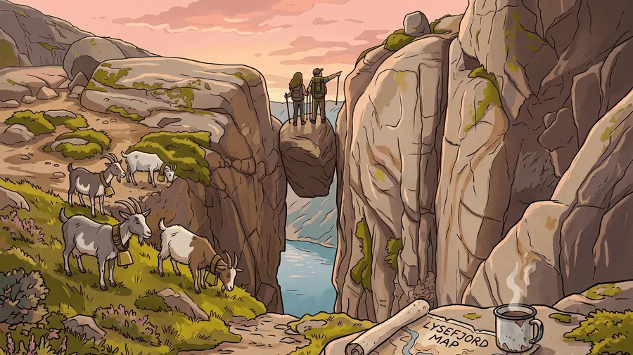
- Kjeragbolten — a stone stuck in a narrow canyon almost one kilometre above the fjord (~100,000 visitors per year). The most interesting thing here is not the stone itself but the cliff edge a few hundred metres to the north-east, one of the meccas for base jumpers, which many people miss.
- Lysebotn — a village at the end of the fjord: a hotel, a cabin, a café, a small shop, kayak rental. Everything works only in high season (mid-May to mid-September).
- Flørli — a small village on the south bank of the fjord with a café and a cabin; famous for its stairway of 4444 steps to a lake at 740 m with a great view of the fjord.
- Stavanger — a beautiful historic centre and museums; near the centre is the lake Stora Stokkavatnet with a small meadow for tents (handy for a night before or after the route).
The main value of the area is not the “postcard” points but the wild nature between them: outside the popular places in the shoulder season, you can walk for days without meeting people.
Useful from other guides
- Hiking & Winter Touring in Sweden — a similar guide about the Swedish mountains (STF instead of DNT, Kungsleden, Abisko/Kebnekaise): useful for comparing the infrastructure and for choosing where to go.